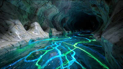
At Oregon Caves National Monument and Preserve in southwestern Oregon, a river flows beneath visitors’ feet through a network of marble passages, disappearing into parts of the cave that people cannot access. Known as the River Styx, it is the subterranean segment of Cave Creek designated for protection under the National Wild and Scenic Rivers System. In a study conducted between 2021 and 2024, scientists from the US Geological Survey (USGS) and the National Park Service used fluorescent dyes to trace its hidden water pathways. The findings revealed connections between the underground river and several small streams in the upper Cave Creek watershed. Researchers also identified 3 previously undocumented places where water from the River Styx resurfaces as springs and seeps below the cave. The results help explain how groundwater moves through the area and provide information relevant to protecting the cave ecosystem and downstream water resources.
River Styx dye-tracing study: how scientists tracked an underground river in Oregon
Oregon Caves National Monument and Preserve is in Josephine County, approximately 11 miles east of Cave Junction. The National Park Service manages 4,554 acres of forests, meadows, streams and cave systems in the area. Oregon Caves, the longest cave in the state, has 3.03 miles of mapped passages. Visitors explore its winding chambers on guided tours, using elevated walkways designed to protect the cave environment and its waterway. The River Styx has been difficult to study because water periodically disappears through cracks and crevices too small for people to enter. Previous internal studies, including a dye trace conducted in 1999, produced ambiguous results. Scientists needed a clearer understanding of which surface streams feed the cave because water moving through the surrounding landscape can carry the effects of surface activities into the underground system.To investigate these connections, the team conducted dye tracing in 2 phases: late 2021, during low-flow conditions, and spring 2024, during peak snowmelt. The timing helped researchers study the system under different water conditions. USGS hydrogeologist Benjamin Miller planned and carried out the work with park staff. The National Park Service’s Geologic Resources Division funded both phases of the investigation. The findings were described in the National Park Service’s Park Science article, “Secrets of the River Styx: Tracking an Underground Waterway,” published on August 29, 2025. The accompanying USGS scientific report, Groundwater Tracing Used to Delineate Recharge Areas and Map Karst Groundwater Pathways for Subterranean Streams at Oregon Caves National Monument and Preserve, was published on January 15, 2026.
Fluorescent dyes, charcoal packets and 42 monitoring sites
The researchers began with a hydrologic inventory that identified 42 suitable monitoring sites, including springs, seeps, cave streams and surface streams. These sites helped the team identify waterways that might be hydrologically connected to the River Styx. Tracking the dye by sight alone would not have worked reliably. As water carried the dye through the underground system, the concentration could become too low for the human eye to detect. Instead, researchers placed charcoal packets at selected monitoring locations. The packets could capture small amounts of dye, allowing scientists to detect its arrival even when the water did not visibly change colour.The team injected fluorescent dyes into selected waterways. The dyes resemble non-toxic food colouring but fluoresce when exposed to high-intensity light. Different dyes have distinct fluorescent properties, allowing researchers to distinguish traces and identify routes followed by water through the system. The investigation focused on surface waterways that could contribute water to the cave, including sinking streams that disappear into soil and marble bedrock. After the initial injections, researchers retrieved charcoal packets every 12 hours to monitor the movement of the tracers. In total, the team conducted 8 dye injections between 2021 and 2024. The results and associated spatial data are available through the USGS data release, Groundwater tracing used to delineate recharge areas for subterranean streams at Oregon Caves National Monument and Preserve.
Three previously unknown resurgences and two distinct groundwater recharge areas
The dye results helped researchers delineate the groundwater recharge area for the section of the River Styx flowing through Oregon Caves. A recharge area is the area where water enters the groundwater system. For Oregon Caves, the mapped area covers 0.51 square miles, primarily in the upper Cave Creek watershed. The USGS report identifies a separate recharge area of 0.69 square miles for a nearby cave it calls Cave Next Door. The National Park Service’s account describes it as another nearby cave and places its recharge area in the upper Panther Creek drainage basin. Although the two caves are only about half a mile apart, the dye traces showed no hydrologic connection between their recharge areas. The results therefore did not support the earlier possibility that the River Styx flowed through both cave systems.Researchers also identified 3 previously undocumented resurgences associated with Oregon Caves, where groundwater emerges at the surface as springs or seeps. Their discovery provides additional evidence of how water moves through the surrounding marble and underground passages. Some dye traces took weeks to reach monitoring sites, despite researchers initially expecting travel times of hours. At certain locations, dye concentrations continued increasing for months. The findings indicate that water can be retained within the underground system, likely because of the complex geology and the different pathways available through the rock. The USGS report also describes substantial variation in groundwater velocities and a significant diffuse-flow component, in which water moves through numerous smaller openings rather than only through larger conduits.
Why the River Styx findings matter for downstream water and wildlife
A key result was confirmation that Cave Creek, a sinking stream, is hydrologically connected to the underground River Styx. The connection matters because water entering the stream can contribute to the underground system, making the surrounding watershed relevant to the protection of the cave’s water quality and quantity. Cave Creek also contributes to downstream ecosystems, including salmon habitat, and provides water to communities in Oregon’s Illinois Valley. Understanding where surface water enters the underground system can therefore help land and water managers assess how activities in the watershed might affect groundwater, cave habitats and downstream resources.The study does not explain every source of the River Styx’s water. Researchers found evidence that substantial amounts of water enter the river from inaccessible parts of the cave system, and some of those origins remain unknown. The findings nevertheless provide a clearer picture of the river’s connections to surface streams and of the areas that recharge the two cave systems. By combining fluorescent dye tracing with charcoal monitoring and mapping, the USGS and National Park Service have identified pathways that were previously difficult to establish. The results provide a scientific basis for understanding the River Styx and protecting the wider watershed on which the underground river, cave ecosystem and downstream communities depend.