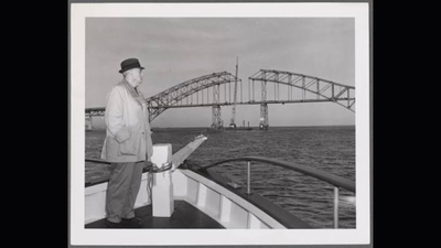
A powerful nor’easter hit the eastern coast of the United States in March 1962. The storm destroyed dunes, swept nearly 100 homes into the Atlantic Ocean, and cut through the narrow barrier island off Long Island’s south shore. The storm, known as the Ash Wednesday Storm, gave famous urban planner Robert Moses what he saw as a chance to push forward his long-planned project. As chairman of the Long Island State Park Commission, Moses proposed building an 18-foot-high sand dike with a four-lane concrete highway on top. The road would run across the length of Fire Island. Moses argued that the highway would hold the shifting island in place during future storms and allow people from New York City to reach the coast by car. Local property owners, however, saw the plan as a serious threat. The proposed 875-foot-wide right-of-way would have taken up most of the island, which is only about 1,000 feet wide on average. Instead of accepting the highway, residents, summer homeowners, and local civic groups launched a strong campaign against it. Their efforts eventually defeated one of New York’s most powerful builders. Their victory not only stopped the highway but also helped convince the federal government to create Fire Island National Seashore in September 1964. Today, 17 private communities still exist within the national park, protected as mostly roadless communities that are mainly reached by boat or on foot.
A master builder faces strong opposition
By the early 1960s, Robert Moses had spent decades changing the New York region through bridges, tunnels, parks, and thousands of miles of parkways. He had wanted to extend Ocean Parkway across Fire Island since the 1920s. After the 1962 storm, Governor Nelson Rockefeller created a state commission to study beach protection, with Moses playing a leading role. The commission proposed a major engineering project that would cost tens of millions of dollars. The plan called for large amounts of sand to be dredged and used to build a tall protective dune. A highway would run along the top and also act as a strong support for the structure. Island residents quickly realized that the highway would change the character of their quiet communities. Places such as Ocean Beach, Cherry Grove, and the Fire Island Pines used wooden boardwalks instead of paved streets and had a peaceful, car-free atmosphere. Local leaders soon organized against the state plan. Developer Maurice Barbash, attorney Irving Like, and Ocean Beach official Arthur Silsdorf helped lead the campaign through groups such as the Fire Island Association and the Citizens Committee for a Fire Island National Seashore. They argued that a large paved highway would damage the island’s fragile environment, including wetlands and maritime forests. Opponents also argued that a large road was a poor solution for a narrow, constantly shifting sand island. In some places, Fire Island is only 600 feet wide. This meant that the proposed construction area could have destroyed entire neighborhoods.
Turning to the federal government
The activists understood that defeating Moses through New York State politics would be difficult. Instead, they turned to Washington and asked the federal government to protect Fire Island. They contacted officials including Interior Secretary Stewart Udall and U.S. Representative Otis Pike and pushed for national park status. According to National Park Service records and local historical archives, opposition groups organized petitions, community rallies, and media campaigns. They worked to show the public that Fire Island had important natural areas, including the ancient Sunken Forest. Their campaign gradually gained support across Long Island. By 1963, support for the highway had weakened badly. State officials eventually pulled their support as public opposition and political pressure increased. On September 11, 1964, President Lyndon B. Johnson signed the law creating Fire Island National Seashore. The law permanently stopped the highway plan and protected 26 miles of shoreline, dunes, and ancient forests.
A unique national park survives
The new national seashore created an unusual balance between protecting nature and allowing private property to remain. Instead of buying and removing every private home, the federal government allowed 17 existing residential communities to stay within the park’s boundaries. These communities include Kismet, Saltaire, Point O’Woods, Ocean Beach, Fire Island Pines, and Davis Park. They operate under local zoning rules intended to protect the surrounding environment. There are no public paved roads connecting these communities directly to the mainland. Residents and visitors usually arrive by passenger ferry from Bay Shore, Sayville, or Patchogue, or use water taxis on the island. Six decades after the fight over the highway, Fire Island remains one of the few barrier islands on the U.S. Atlantic coast where motor vehicles are heavily restricted. Because Moses’s highway was never built, the barrier island has been able to keep much of its natural movement and form, helping protect both its residential communities and the wildlife areas around them.